Frameries
Appearance
You can help expand this article with text translated from the corresponding article in French. (August 2016) Click [show] for important translation instructions.
|
Frameries
Framrie (Picard) | |
|---|---|
 Church Square and the big sundial | |
| Coordinates: 50°24′N 03°54′E / 50.400°N 3.900°E | |
| Community | French community |
| Region | Wallonia |
| Province | Hainaut |
| Arrondissement | Mons |
| Government | |
| • Mayor | Jean-Marc Dupont (PS) |
| • Governing party/ies | Coalition PS-MR |
| Area | |
| • Total | 26.09 km2 (10.07 sq mi) |
| Population (2018-01-01)[1] | |
| • Total | 21,878 |
| • Density | 840/km2 (2,200/sq mi) |
| Postal codes | 7080 |
| NIS code | 53028 |
| Area codes | 065 |
| Website | www.frameries.be |
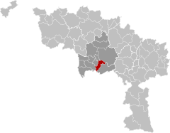
Frameries (French pronunciation: [fʁam(ə)ʁi]; Picard: Framrie; Walloon: Framriye) is a municipality of Wallonia located in the province of Hainaut, Belgium.
The municipality consists of the following districts: Eugies, Frameries, La Bouverie, Noirchain, and Sars-la-Bruyère.
Sport
[edit]Frameries is home to Rugby Union club RC Frameries who currently play in the Belgian Elite League and hosts the finish of the Grand Prix Pino Cerami cycling race.
Personalities
[edit]- Eugène Boch, painter and friend of Vincent van Gogh[2]
- Auguste Toubeau, trade unionist
Twin towns
[edit]- La Chaux-de-Fonds, Switzerland
- Issy-les-Moulineaux, France
- Willmar, Minnesota, USA
Image gallery
[edit]-
St. Waltrude's church
-
Châssis à molette (Wallonia French, also Belfleur; French chevalement), Gallow frame of the Crachet (reconstruction) in Frameries
References
[edit]- ^ "Wettelijke Bevolking per gemeente op 1 januari 2018". Statbel. Retrieved 9 March 2019.
- ^ [1] Letter sent by Vincent van Gogh to Frameries
External links
[edit] Media related to Frameries at Wikimedia Commons
- Official website (in French)
- Rugby Club Frameries (in French)
- Football Club in Frameries (in French)


